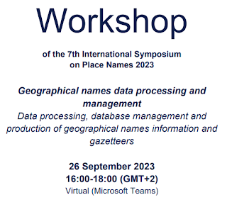
Date: 26-Sep-2023
Location: Microsoft Teams, South Africa
Contact: Chrismi Loth
Contact Email: kongresETFB@ufs.ac.za
Meeting URL: https://www.ufs.ac.za/conferences/conference/2023-international-symposium-on-place-names/ispn-2023/ispn-2023-home-page
Presenter: Pier-Giorgio Zaccheddu, Convenor of the Working Group on Geographical Names Data Management of UNGEGN
Language: English. Indicate with registration if South African Sign Language interpretation is required.
Content
- Building a database for GN management
- Disseminating GN for different purposes (using free and open-source software)
- GN: a "fundamental data theme" as referenced by UN-GGIM and standardized by UNGEGN
- Additional sub-topic: Linked Open Data considerations for GN management
After the name information has been gathered in the field, this information has to be stored and prepared for dissemination. Several methods exist for storing the data, from the paper cards being an old-fashioned but proved media, to the advanced digital techniques using databases. For storage of names information in a digital format, one has several options. Databases have the advantage that data can be connected with other information in other databases and that it can be processed in many ways.
When creating a database, one has to consider very carefully the layout and the structure of the database tables. Usually, the core table will hold one row for each geographical name. The definition of columns (fields) may vary considerably from country to country, but there are general rules that apply to most databases of geographical names. Typical fields associated with a geographical name are feature type, coordinates, variant names, textual description, source of the name information and status of the name. Several database software solutions can be used to create a database. The presentation will demonstrate how the database table structure can be defined and the data from the field collection can integrated. It can be explained how to import the database content into other systems, like geographic information systems (GIS). It can be demonstrated how to display names from the database in a GIS or by using Google Maps/Earth or other applications.
In a nutshell, the participants will learn on the layout, structure and characteristics of a names database, insert the data from the field collection into a database, print a gazetteer from the database and, if applicable, create a gazetteer and a map with the geographical names in a Geographical Information System (GIS).
In both communities, the United Nations Group of Experts on Geographical Names (UNGEGN) and the United Nations Global Geospatial Information Management (UN-GGIM), geospatial information, as an underpinning enabling infrastructure, is used in general or with a distinct relation to geographical names. Geographical names are used throughout the world as a geographic identification system and thus have potential to inter-relate and cross-reference disparate data sources, both geospatial and non-geospatial. Standardised geographical names are essential for effective communication between citizens, governments of all levels, decision-makers, and policymakers. Furthermore, geographical names are often used for geocoding and mapping. They are considered to be a "fundamental data theme" as referenced by UN-GGIM. These relations between UNGEGN and UN-GGIM can be explained.
Some future trends as volunteered geographic information and crowd sourcing can be mentioned as well. Amongst others, that crowd-sourced content will decrease cost, improve accuracy, and increase availability of rich geospatial information. It is envisaged that progress will be made in future on bridging the gap between authoritative data and crowd-sourced data, moving towards true collaboration.


No comments:
Post a Comment